Category:Sheltered housing
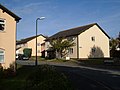
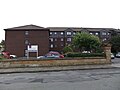
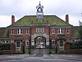
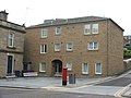
Sheltered housing is a term covering a wide range of rented housing for older and/or disabled or other vulnerable people. Most commonly it refers to grouped housing such as a block or "scheme" of apartments or bungalows with a scheme manager or "officer"; traditionally the manager has lived on-site although this is not always the case these days. (Managers/officers used to be called "wardens" but this term is now felt to be out of date.)
Sheltered housing schemes are generally owned, run and maintained by a housing trust, usually a not-for-profit organisation which works closely with and is part-funded by the local authority.
housing providing a level of social support for residents .jpg) | |||||
| Upload media | |||||
| Subclass of | |||||
|---|---|---|---|---|---|
| |||||
Subcategories
This category has the following 4 subcategories, out of 4 total.
Media in category "Sheltered housing"
The following 75 files are in this category, out of 75 total.
-

-
 Anchor Court - Jervaulx Crescent - geograph.org.uk - 408693.jpg 640 × 315; 58 KB
-
 Anchor Housing - Oakworth Road - geograph.org.uk - 831453.jpg 640 × 429; 48 KB
-
 Arthington, Torquay - geograph.org.uk - 257383.jpg 640 × 480; 68 KB
-
 Atherton Court, New Brighton - DSCF1109.JPG 4,000 × 3,000; 2.87 MB
-
 Bell Orchard - geograph.org.uk - 119731.jpg 640 × 480; 98 KB
-

-
 Chandos Court - geograph.org.uk - 115481.jpg 640 × 480; 65 KB
-
 Churchfield Court - geograph.org.uk - 660732.jpg 640 × 459; 69 KB
-

-
 Dray Court - geograph.org.uk - 1154375.jpg 640 × 424; 53 KB
-
-
 Eaton House, Exeter - geograph.org.uk - 271650.jpg 640 × 480; 82 KB
-
 Great Close, Barton - geograph.org.uk - 705874.jpg 640 × 480; 61 KB
-
 Greenwich Place - geograph.org.uk - 709975.jpg 640 × 427; 211 KB
-
 Hazlehurst Court - Leeds Road - geograph.org.uk - 362495.jpg 637 × 314; 35 KB
-
 Hirst Gardens, Burnley - geograph.org.uk - 992919.jpg 640 × 480; 180 KB
-
 Homegrove House in Grove Road North - geograph.org.uk - 809284.jpg 640 × 480; 99 KB
-
 John Eddie Court - geograph.org.uk - 685738.jpg 640 × 453; 66 KB
-
 Lo res main H21 2 colour.jpg 179 × 42; 20 KB
-
 McErlane Square - geograph.org.uk - 201759.jpg 640 × 480; 91 KB
-
 Old Folks Home, Stakeford - geograph.org.uk - 69502.jpg 640 × 480; 49 KB
-
 Salmon Court - geograph.org.uk - 530382.jpg 640 × 480; 79 KB
-
 Sheltered housing - geograph.org.uk - 112870.jpg 640 × 480; 59 KB
-
 Sheltered Housing - geograph.org.uk - 462152.jpg 600 × 450; 224 KB
-
 Sheltered Housing Complex, Bagnall - geograph.org.uk - 339315.jpg 640 × 480; 51 KB
-
 Sheltered housing in Almshouse Croft - geograph.org.uk - 401312.jpg 600 × 450; 192 KB
-
 St Anne's Court from Prescot Road L13.JPG 4,608 × 3,456; 3.37 MB
-

-

-
 Vuohenojan palvelutalo.jpg 1,884 × 1,239; 1.31 MB
-
 Watersmead - geograph.org.uk - 116449.jpg 640 × 480; 72 KB
-
 Whittle Court - geograph.org.uk - 110232.jpg 640 × 480; 46 KB
-
 Windmill Hills Old Folks Home - geograph.org.uk - 70733.jpg 640 × 480; 66 KB
-
 Abbeyfield Homes - North Park Road - geograph.org.uk - 1071696.jpg 640 × 463; 234 KB
-
 Acacia Court - Chaston Road - geograph.org.uk - 1067413.jpg 480 × 640; 69 KB
-

-

-
 Another Zoom - geograph.org.uk - 197532.jpg 640 × 480; 39 KB
-
 Arbourtree Court - geograph.org.uk - 290755.jpg 600 × 450; 230 KB
-

-
 Beckett's Close - geograph.org.uk - 474466.jpg 640 × 427; 88 KB
-
 Brennan House, Gillingham - geograph.org.uk - 1390936.jpg 640 × 480; 85 KB
-
 Brooklands Court - geograph.org.uk - 1134563.jpg 640 × 426; 82 KB
-
 Build Date - geograph.org.uk - 1422606.jpg 640 × 480; 100 KB
-
 Burdale Close, Hull - geograph.org.uk - 320325.jpg 640 × 466; 93 KB
-
 Carl Hall Court - geograph.org.uk - 474463.jpg 640 × 427; 97 KB
-
 Carleton House, Church Street, Portadown. - geograph.org.uk - 568357.jpg 640 × 480; 115 KB
-
 Cliff House - geograph.org.uk - 634742.jpg 640 × 427; 56 KB
-
 Cliffe Cottages, Corton Road, Norwich - geograph.org.uk - 677730.jpg 640 × 480; 95 KB
-
 Flower Haven - Haworth Road - geograph.org.uk - 643012.jpg 640 × 387; 79 KB
-
 Furlong House - geograph.org.uk - 507701.jpg 640 × 506; 203 KB
-
 Glenfield House - geograph.org.uk - 175743.jpg 640 × 480; 274 KB
-
 Green Bank Court, Baildon - geograph.org.uk - 163756.jpg 640 × 480; 100 KB
-
 Henbury Court - geograph.org.uk - 662783.jpg 639 × 478; 103 KB
-
 Homeregal House, Rayleigh - geograph.org.uk - 490925.jpg 640 × 451; 82 KB
-

-
 Langley Court - geograph.org.uk - 289408.jpg 600 × 450; 238 KB
-
 Melrose Court, Victoria Road, Elland - geograph.org.uk - 91654.jpg 640 × 464; 118 KB
-
 Nelson Mandela House - geograph.org.uk - 376163.jpg 600 × 450; 232 KB
-
 New Care Home on the Wergs Road - geograph.org.uk - 301529.jpg 600 × 450; 251 KB
-
 Old Folks' Home - geograph.org.uk - 67835.jpg 640 × 480; 75 KB
-
 Park Road, Haltwhistle - geograph.org.uk - 208896.jpg 640 × 480; 74 KB
-
 Quarry Gardens - geograph.org.uk - 675078.jpg 640 × 480; 52 KB
-
 Ravenswood - geograph.org.uk - 121588.jpg 640 × 480; 85 KB
-
 Road outside Doune Court - geograph.org.uk - 674991.jpg 640 × 480; 97 KB
-
 Rother House in Hillbrow Road - geograph.org.uk - 1276444.jpg 640 × 480; 69 KB
-
 Scholebrook Court - Broadfield Close - geograph.org.uk - 701379.jpg 640 × 441; 61 KB
-
 Sheltered housing off Willenhall Road - geograph.org.uk - 251490.jpg 640 × 480; 224 KB
-

-
 St Anthony's Cheshire Home - geograph.org.uk - 291474.jpg 600 × 450; 205 KB
-
 St Matthews Place on Willenhall Road - geograph.org.uk - 251538.jpg 640 × 480; 249 KB
-
 St. Andrew's House - geograph.org.uk - 257241.jpg 640 × 459; 83 KB
-
 Sutton House - Dick Lane - geograph.org.uk - 665749.jpg 640 × 409; 35 KB
-
 Sycamore Court - geograph.org.uk - 587885.jpg 640 × 379; 31 KB


